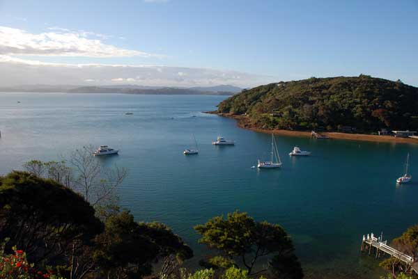
Great Boating Holidays Begin in the Hauraki Gulf | | Auckland boasts the busiest recreational harbour in New Zealand and consequently is known as "The City of Sails". It is fortunate to have on its doorstep one of the world`s largest cruising grounds. With 1500 nautical miles of coastline to explore, including numerous islands within short sailing distances providing a wide choice of anchorages and unspoilt beaches, the Hauraki Gulf provides the perfect destination for your cruising holiday. http://www.doc.govt.nz/haurakigulfmarinepark | 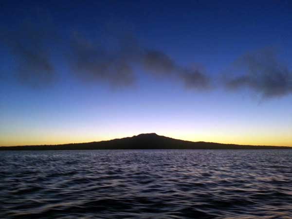 | The iconic Rangitoto cone is the youngest of Auckland`s volcanos; only 700 years old. It is the closest island to Auckland city, and Islington Bay, the main anchorage, is only about 8 miles by sea from our base at Bayswater, making this an ideal first or last stop on a trip. It has an amazing volcanic landscape of black lava slowly being colonised by moss, plants and trees including the largest Pohutukawa forest in the world. | | It has been a Recreation Reserve since 1890. A brisk walk to the summit (260m altitude, takes an hour or two!) from Islington Bay rewards with magnificent views of the Hauraki Gulf. There are also other walks, both short and long on the island. | 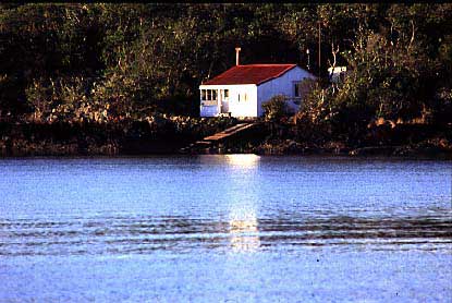 | 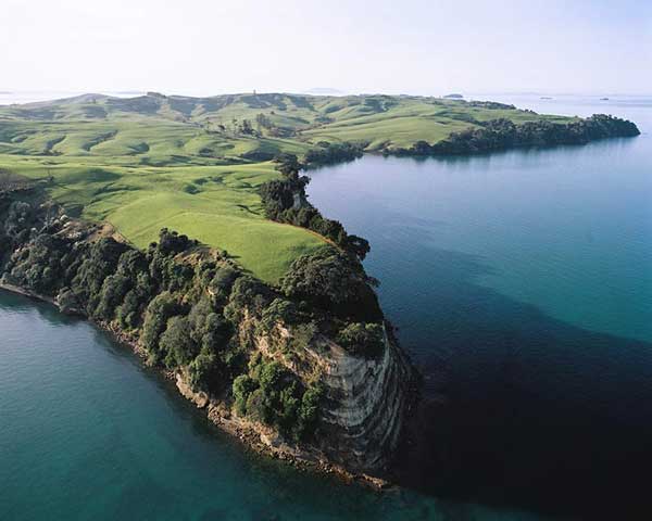 | Attached to Rangitoto by a narrow causeway; it is quite different in character and is a farmed reserve within the Hauraki Gulf Maritime Park. Sheltered bays, beaches and walks are features of this island. It has WW11 gun emplacements and a more extensive area of defence buildings at the northern end. Replanting is taking place on parts of the island | | Also very close to Auckland city; a recreation reserve with an interesting history, and very popular with day trippers on fine summer days. It has a beach and sheltered anchorage for every wind direction: Ocean Beach on the north side is a beautiful long golden sandy beach and on the south side is a smaller lovely beach. In 2005 it was declared pest free and native bush and wildlife are now being restored to the island. There are numerous walking tracks and it is possible to walk around most of the coastline at low tide. It was for many years the Quarantine Station for Auckland, later became the Training establishment of the Royal New Zealand Navy, and was in World War One a prison camp for German prisoners of war. Famously, Count Von Luckner escaped from the island by stealing the Commandant's Launch... go ashore and see if you can hear the echoes of the past on this lovely little island! |  | 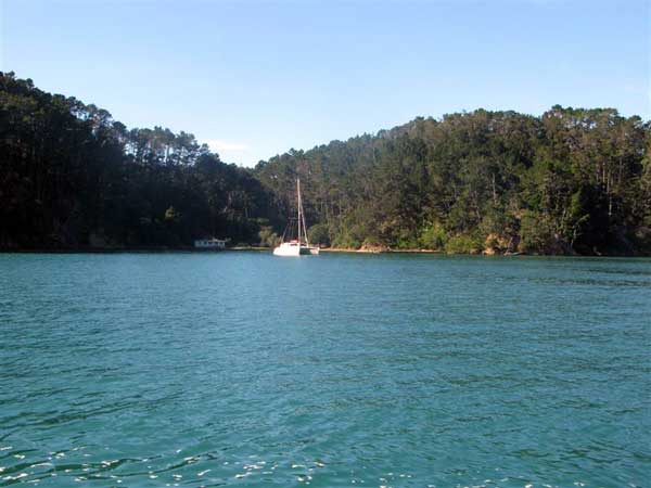 | 12 miles in length, beautiful Waiheke boasts 22 established vineyards, an array of dining options from silver service to beach cafes, golden, safe, sandy, swimming beaches and delightful cliff top walks: all adding up to make it a holiday destination in itself. Oneroa, the hub of Waiheke has a unique village atmosphere and is a good place to buy local crafts and restock supplies, sample award winning wines and the interesting collection of cafes and restaurants. Stony Batter on the eastern end, named after the rock formations, is also home to a WW11 defence system with an assortment of tunnels, chambers, and gun emplacements .
| | A visit to the Man O' War vineyards on the Eastern side is well worth the effort with their fine cuisine and great wines. http://www.manowarvineyards.co.nz/ This attractive island is now a suburb of Auckland with regular fast ferries from Matiatia. It has major communities mainly on the western end of the island. The northern bays are only suitable for settled southerly conditions whereas the southern side of Waiheke is ideal in northerlies or easterlies. On the east side of Waiheke Pakatoa, Ponui and Rotoroa Islands beckon with secluded sandy bays and secure anchorages for all conditions. | 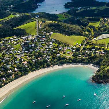 | 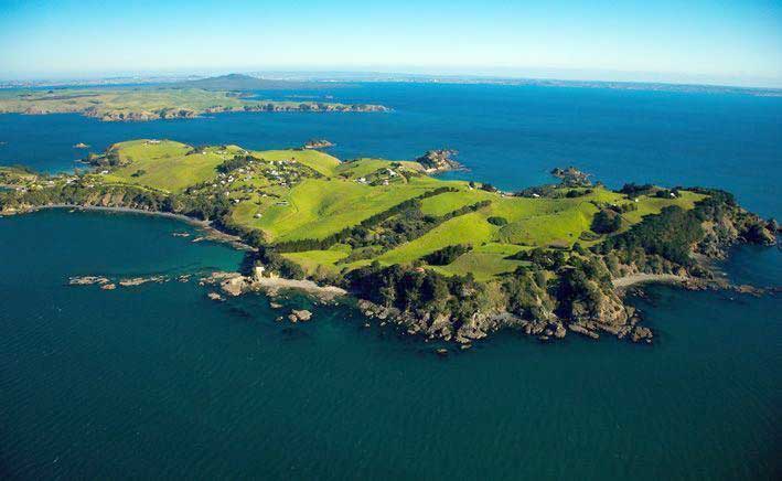 | A charming island with a small community of houses, mostly holiday homes. Woody Bay is a great anchorage in a north easterly and has a pleasant sandy beach with an access road to the top of the island from where it is a pleasant walk to the wharf at the other end. | | Tiri is administered by the Department of Conservation as a scientific reserve, protecting the island for its wildlife, conservation, scientific, recreational and historical values. It is reverting to its original forest with an extensive planting programme. There are several walking tracks on the island, and the birdlife is stunning... tame Tuis, Saddlebacks, Wood Pigeons, and the previously extinct Takahe are a real thrill! The lighthouse built in 1864 is one of the oldest in New Zealand and the only one easily accessible to the public. Daytime anchorage can be found north of the wharf and behind the reef. http://www.tiritirimatangi.org.nz/ | 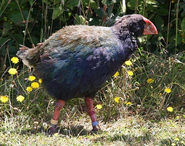 | 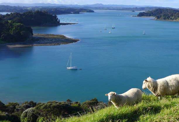 | West of Kawau, along 5 miles of beautiful pohutakawa cliffs and coves, passing inside the islands of Moturekareka, Motuketekete and Motuora, sheltered by Te Haupa Island, the Mahurangi Harbour is a scenic gem. It is the mouth of the Mahurangi River which can carry you to the township of Warkworth on a high tide. However its lower reaches provide anchorages at beaches such as historic Scott's Landing or stunning Otarawao Bay. | Kawau has an interesting history. After centuries of Maori occupation it became the site of one of New Zealand`s earliest mining ventures with manganese and copper mining. Later, from 1862 - 1888, the Governor Sir George Grey made it his home and remodelled the residence of the mine superintendant, now known as the Mansion House. He planted hundreds of plant species and introduced many exotic and native animals. Wallabies have only recently been removed from the island. A Historic Reserve has been created to protect the Mansion House and its gardens, the surrounding landscape and the relics from the Copper Mining industry.
|  | 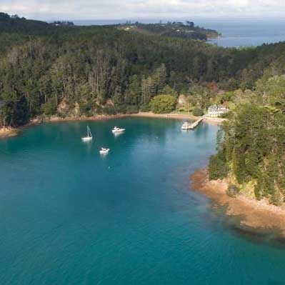 | You can visit the house, walk around the grounds or over to Coppermine Bay. Native bush and exotic trees cover most of the island with some farming land and holiday homes nestled around the many bays on the sheltered west coast. Mansion House Bay is a very popular anchorage and there are several other bays on both sides of Bon Accord harbour, a 3km long inlet which almost divides the island in two. Other anchorages include Vivian Bay and Coppermine Bay. North Cove is the most sheltered anchorage, but unfortunately is mostly filled with moorings. There are also anchorages on the mainland coast of Kawau Bay: Christian Bay for example is excellent in North Westerly conditions. https://en.wikipedia.org/wiki/Kawau_Island | Motutara, Moturekareka, Motuketekete | | Motutara, Motuketekete, and Moturekareka are three islands south of Kawau which can be great anchorages and snorkelling spots in the right weather conditions. Nearby are the picturesque Beehive Island and Martello Rock...(no, it's not a surfaced submarine!) Moturekareka has the remains of the steel sailing ship, %u201CRewa,%u201D which was towed there and sunk for the hermit Charles Hanson to form a breakwater. Unfortunately she settled in the wrong place which resulted in a rather small harbour. | 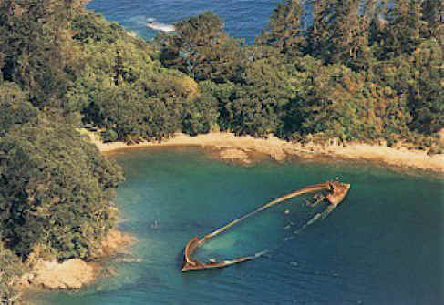 | 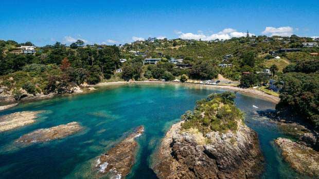 | Barrier is the largest of the Hauraki Gulf islands. It is approximately 22 nautical miles long and has a natural sound-like harbour, Port Fitzroy, Fitzroy is protected by Kaikoura, a rugged and remote island, and entry to Fitzroy through the narrow and deep Man-of- War Passage is a great adventure for the careful navigator!. Port Fitzroy is a very sheltered harbour comprising of many bays and inlets all within easy sailing distances. The Department of Conservation administers much of the forestland covering the Island and has developed many walks in the area. | | You can pick up a leaflet at the local store or check out the DOC website www.doc.govt.nz/parks-and-recreation/tracks-and-walks/auckland/great-barrier-area . Historical sites are in evidence: the site of Australasia`s first ship building yard, a whaling station, kauri dams, gold and copper mines and ship wrecks. There are also natural mud pools, and Smokehouse Bay has an old bath complete with fire to heat the water! Whangaparapara harbour is a splendid fiord-like bay, surrounded by high hills and old world charm. There are bush walks and a lodge where you can have breakfast, lunch, dinner or morning or afternoon tea. | 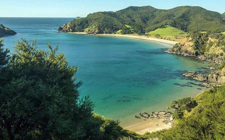 | 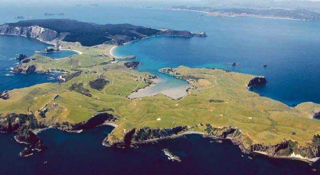 | The Mercs, situated on the Eastern side of Coromandel, but within Charterlink's charter area, consist of 6 islands that are nature reserves and Great Mercury Island which is privately owned by the Fay/Richwhite families. Access is restricted on all the islands, but beach access is granted on Great Mercury, which has a very snug anchorage called Mercury Cove. Peach Grove Bay on the south side has a tree-lined lagoon inhabited by thousands of shags.... also well worth a visit. | | Coromandel is a long, majestic peninsula largely protecting the Hauraki Gulf from easterly winds and ocean swells. On its western side are Coromandel Harbour and Te Kouma: secluded harbours with enchanting bays and sandy beaches. The historic mining town of Coromandel, only accessible at high tide even by dinghy, offers quaint cafes which specialise in seafood delicacies from the local marine farms. Out around Cape Colville the eastern side is open to the big ocean swells: bays on this side can get very uncomfortable as the wind drops off! | 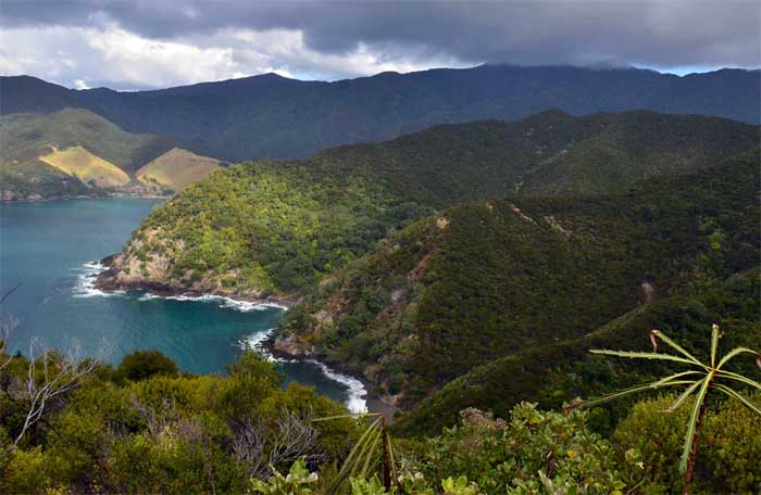 | |
Yacht Chartering News & Updates
Pest Free Hauraki Gulf Update
Help Keep The Hauraki Gulf Pest Free - Infomation For Bareboat Charterers
READ MORE
Why Not Have your own Yacht !!
If you are contemplating buying a yacht for use in our beautiful Hauraki Gulf,
Charterlink offers shared ownership schemes where one or two
people own a yacht, and Charterlink manages charters
on her;
READ FULL OWNERS FAQ
|
Cruising Grounds
|

|
